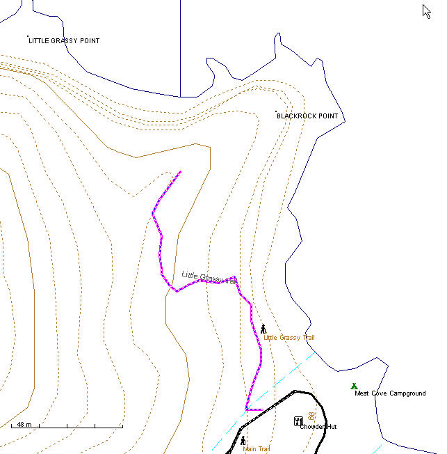
Little Grassy Trail This 0.6 km trail starts on the right hand side of the road as you head up the hill just past the campground office and is marked with flagging tape. From the road it drops down to the creek then gradually rises to a knoll overlooking the coast and Meat cove from a height of 420 ft. If you only have time for one trail this should be the one, it offers stunning views for the least effort of any trails in the area.
About these Maps
These maps are compiled with data from Geo Gratis (see legal below) and GPS tracks from actual hikes, these trails are marked with a bold dashed line other trails may be indicated that I don't have the data for with a faint dashed line. If you have the data in GPX file format and wish to contribute please contact me.
Legal
No guarantee is made as to the accuracy of these maps or suitability for any particular purposes, in some cases there are known inaccuracies.
The underlying data for these maps comes from the Geo Gratis website Department of Natural Resources Canada and as such is subject The Geobase Unrestricted Use License Agreement details of which can be found here http://www.geobase.ca/geobase/en/licence.jsp The use of this data does not construe the endorsement of any. third party.
This maps where made with free and open source software. You may make copies of them by print or electronically, and give them away, but under no circumstance may you sell them.