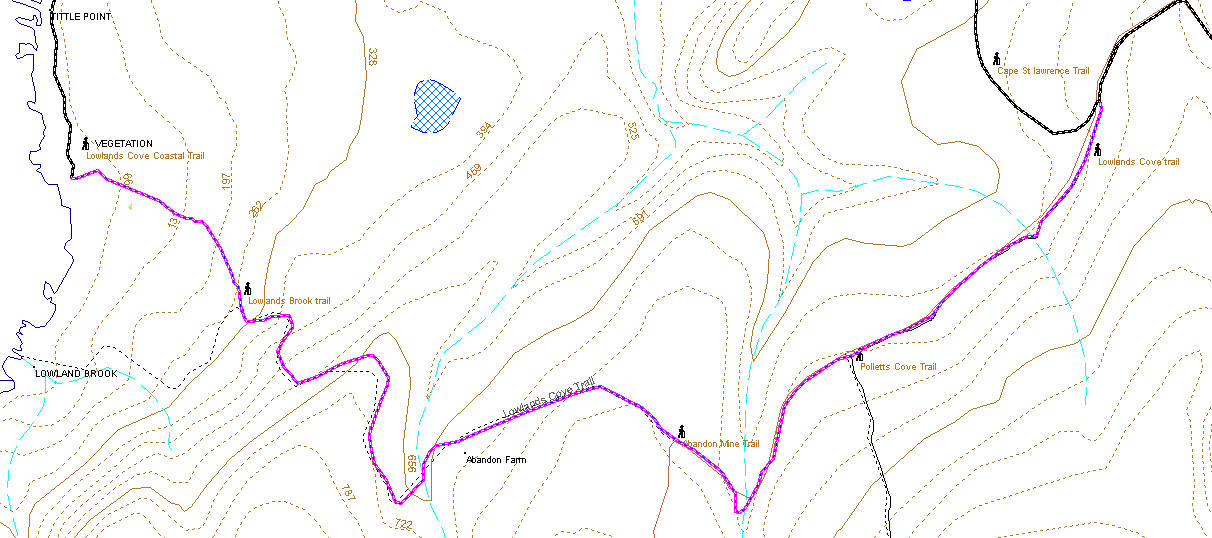
Lowlands Cove Trail 5km to the coast from the Cape St Lawrence turn off or 7 km from the camp ground.
Instead of taking the Cape St Lawrence turn off at the 2 km mark keep straight on after another kilometer you will see the Pollets Cove turn off to your left, after about another kilometer you should see the disused road and trail to the abandon zinc mine also to the left (1.5 km), another 0.75 km takes you to an abandoned farm all that remains is a clearing and some farm implements. The trail proceeds gradually down to the coast, the old road bed is washed out at the brook just passed the abandon farm but is easy to cross with dry feet in summer months. The topographic map indicates a side trail heading to the campsite at Lowlands Cove as of July 2010 this old road appears unused in some time, the current trail takes you to the coast about 0.5km north of Lowlands Cove brook but it is an easy hike along the coast to the brook and campsite.
GPS Waypoints
Cape St Lawrence light Turn N47°01.423'W60°34.696'
Cattle Corral N47°01.560' W60°34.381'
Meat Cove Look Turning N47°01.413' W60°34.233'
Meat Cove Lookout N47°01.225' W60°34.146'
View of Light from 525ft N47°01.796' W60°35.277'
Polletts Cove Turn off N47°01.013'W60°35.294'
Abandoned Farm N47°00.856'W60°36.219'
Washed out Bridge N47°00.825'W60°36.318'
Lowland Cove inland/Coastal junction N47°01.299' W60°37.144'
Wooden gate N47°01.446' W60°34.150'
GeoCache Location GCXANC Lowland Cove 47.016417 North 60.620183 West
About these Maps
These maps are compiled with data from Geo Gratis (see legal below) and GPS tracks from actual hikes, these trails are marked with a bold dashed line other trails may be indicated that I don't have the data for with a faint dashed line. If you have the data in GPX file format and wish to contribute please contact me.
Legal
No guarantee is made as to the accuracy of these maps or suitability for any particular purposes, in some cases there are known inaccuracies.
The underlying data for these maps comes from the Geo Gratis website Department of Natural Resources Canada and as such is subject The Geobase Unrestricted Use License Agreement details of which can be found here http://www.geobase.ca/geobase/en/licence.jsp The use of this data does not construe the endorsement of any. third party.
This maps where made with free and open source software. You may make copies of them by print or electronically, and give them away, but under no circumstance may you sell them.