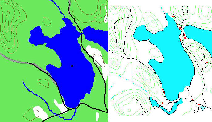
Topo comparison
Ibycus 1:50,000 GeoNova 1:10,000
 |
|||||
| Part of 021a06 Ibycus map all shapes are correct
|
|||||
 |
|||||
| Part of map produced from GeoNova 1044300065200 shapefiles covering the same area, the main problem appears to be WA_POLY.shp which doesn't differentiate between lakes and wet areas (in this case some of the wet areas contain 40ft trees). It also misses many of the islands totally, no doubt I am doing something wrong but I have been un-able to locate additional files to cover these areas as in the case of the shapefiles in the GeoGratis files for 021a06 covering the same area. | |||||