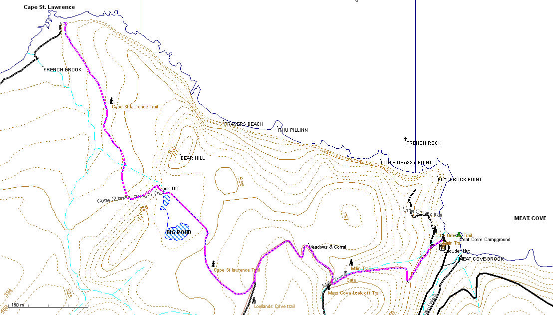
Cape St Lawrence Trail . Trail length 5km one way, maximum elevation 850ft. This Trail starts by the Office at the campground (check with office if you plan to leave your vehicle near here) on the gravel road and changes to a narrow track after 150 meters and proceeds up the hill. This is by far the steepest and most challenging part of the hike in the first kilometer you will climb nearly 700ft and pass by a wooden gate and the sign for the Meat Cove Look Off trail to your left, by the time you reach a meadow and corral to your right most of the climbing is finished. About 2 kilometer from the start you will see the side trail to Cape St Lawrence to your right, as of July 09 this was well marked with flagging tape on both sides, it’s the first trial to your right past the meadows of any size and suitable for an ATV or horse and cart originally.
The rest of the hike is an easy 3km proceeding gradually down hill except for one short steep section, be sure to check the look off at the top of this section just past Big Pond.
There are a few well established sheltered campsites at Cape St Lawrence, French Brook
GPS Waypoints
Cape St Lawrence light Turn off N47°01.423'W60°34.696'
Wooden gate N47°01.446' W60°34.150'
Meat Cove Look Turning off N47°01.413' W60°34.233'
Cattle Corral/
Meadows N47°01.560' W60°34.381'
View of Light from 525ft N47°01.796' W60°35.277'
Geocache
G4XAN8 Cape St Lawrence 47.041167 North 60.598017 West
About these Maps
These maps are compiled with data from Geo Gratis (see legal below) and GPS tracks from actual hikes, these trails are marked with a bold dashed line other trails may be indicated that I don't have the data for with a faint dashed line. If you have the data in GPX file format and wish to contribute please contact me.
Legal
No guarantee is made as to the accuracy of these maps or suitability for any particular purposes, in some cases there are known inaccuracies.
The underlying data for these maps comes from the Geo Gratis website Department of Natural Resources Canada and as such is subject The Geobase Unrestricted Use License Agreement details of which can be found here http://www.geobase.ca/geobase/en/licence.jsp The use of this data does not construe the endorsement of any. third party.
This maps where made with free and open source software. You may make copies of them by print or electronically, and give them away, but under no circumstance may you sell them.